


Most hiking apps are built around the next outing: find a trail, record a route, check a forecast. But the part I kept thinking about was everything that remains after the hike. The peaks become memories, scattered photos, and names you gradually forget. I wanted one place where those mountains could accumulate into something that felt personal.
That idea became mntn passport: a personal mountain passport for hikers, coming to iOS and Android. It is designed to remember the summits you have reached, make the vertical you have climbed tangible, and help friends discover the mountains in one another’s lives.
The mountain is more than a pin
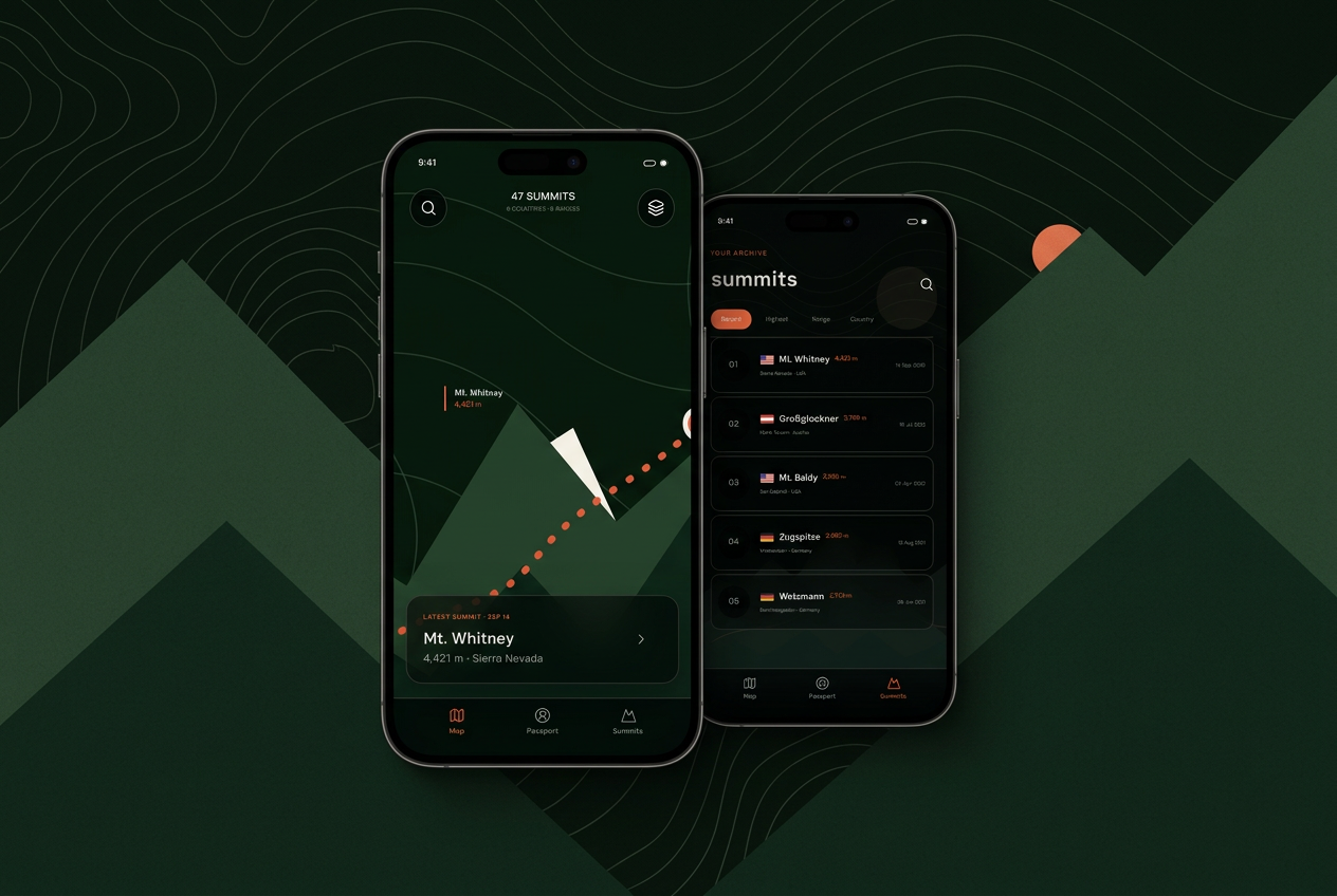
A summit is a place, but it is also a date, a route, a country, a range, a set of photographs, and a story. The early product work started with a simple question: what would a passport look like if each stamp represented a mountain you had actually climbed?
The answer is a living record organized around three views: a terrain map for where you have been, a passport for the larger story, and a summit collection for the individual climbs. The goal is not to turn the mountains into a checklist. It is to give the effort and memories a durable home.
A passport that grows with every climb
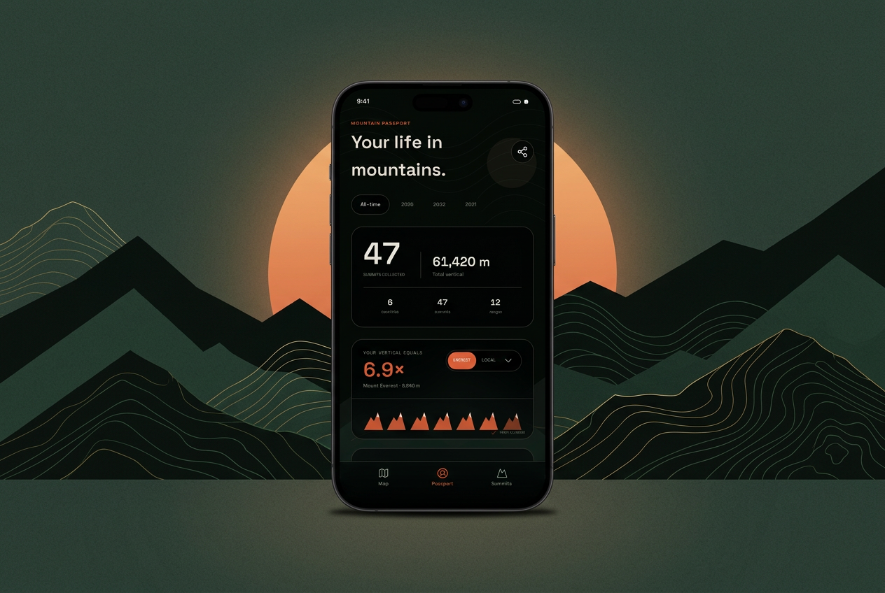
At the center is the passport summary: summits climbed, countries and ranges visited, the highest point reached, and the combined vertical of the mountains in your history. It should answer the familiar questions quickly, while still leaving room for the details that make each climb yours.
- A map of recorded summits and the regions they belong to
- A personal summit collection with dates, elevation, photos, and notes
- Lifetime totals across mountains, ranges, and countries
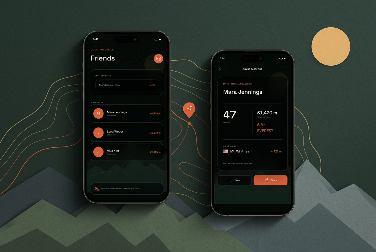
- A portable passport graphic that can be shared beyond the app
Making thousands of vertical meters feel real
Total elevation is an interesting number, but large numbers become abstract quickly. One of the most enjoyable ideas in the prototype is translating combined vertical into landmarks that mean something: how many times have your summits added up to your local highest peak? How far are you through the height of Everest?
This is not a claim that climbing several smaller mountains is the same as climbing one enormous one. It is a playful way to make a lifetime total understandable. A number becomes a journey, and the next milestone becomes visible.
Your local highest peak might be one day on the trail. Your combined mountain history can pass it again and again.
Social, without becoming a performance
The social part matters because mountains are rarely experienced in isolation. Friends recommend routes, compare weekends, discover that they climbed neighboring peaks, and inspire one another to go back outside. But I do not want mntn passport to become another attention economy with public follower counts and an endless engagement feed.
The product direction is intentionally smaller and more private. You invite a friend, they accept, and you can explore one another’s passports. Nearby climbing history becomes useful context: who has already been up that peak, what else have friends climbed in the same range, and which mountain might bring people together next?
What the early prototype taught me
The project began as Mountain Flow Monitor, a prototype for exploring what a mountain-centered product could feel like. Building the screens before every underlying feature existed was useful: it made the product language concrete and exposed where a conventional activity tracker would pull the idea in the wrong direction.
A highly detailed map can easily overpower the passport. A social feed can make personal history feel performative. Statistics can become competitive instead of reflective. The design therefore moved toward terrain as atmosphere, clear functional surfaces for everyday use, and measurements that help a hiker understand their own story rather than rank it against someone else’s.
The name changed with that focus. mntn passport says what the product is trying to preserve: not a stream of activities, but a collection that belongs to you and becomes more valuable over time.
Designed for more than one mountain language
Mountain culture crosses borders quickly, especially in the Alps. The product direction includes English and German from the beginning, with units, place names, ranges, and countries treated as first-class parts of a summit rather than decoration added later.
That international foundation matters even for a small first release. A passport should travel. The architecture and interface need to leave room for more regions, languages, and mountain data without pretending that broad coverage is already complete.
Coming to iOS and Android
mntn passport is in development for iOS and Android. The current work is focused on turning the product direction into a dependable mobile experience: recording real summits, making the passport useful from the first climb, and keeping friendship and sharing private by default.
There are still product decisions to make and trail miles to walk before the store links appear. But the north star is clear: every mountain should add to a history you can see, understand, and carry with you.
mntn passport
A mountain passport for hikers, coming soon to iOS and Android.
Download links will be added here once the app is available.